
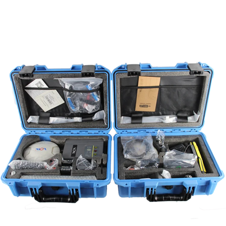
Высокопроизводительный FOIF A90 GPS RTK двухчастотный GPS-приемник для базового Rover 800 каналов опрос иду
- Категория: Other Test Instruments >>>
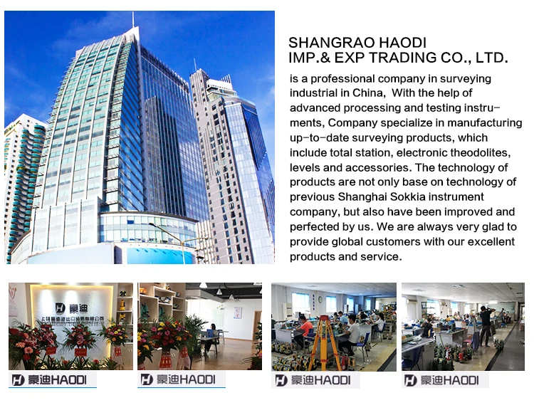
- Поставщик: Shangrao,Haodi,Imp&Exp,Trading,Co.,Ltd.
Поделиться:
Описание и отзывы
Трекер стоимости
| Месяц | Минимальная цена | Макс. стоимость |
|---|---|---|
| Sep-18-2025 | 4820.13 $* | 5061.36 $* |
| Aug-18-2025 | 4779.56 $* | 5018.51 $* |
| Jul-18-2025 | 4010.6 $* | 4211.97 $* |
| Jun-18-2025 | 4698.32 $* | 4933.18 $* |
| May-18-2025 | 4091.7 $* | 4296.34 $* |
| Apr-18-2025 | 4617.77 $* | 4848.91 $* |
| Mar-18-2025 | 4577.79 $* | 4806.15 $* |
| Feb-18-2025 | 4536.20 $* | 4763.58 $* |
| Jan-18-2025 | 4496.36 $* | 4721.11 $* |
Характеристики

Company Information

Company Information

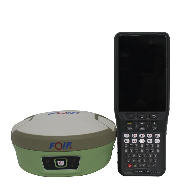
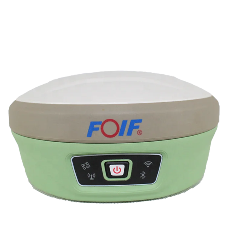
A90 Intelligent GNSS Receiver
 | •Compact design, more productive.
•professional GNSS satellites tracked
simultaneously.
(GPS,Glonass,Galileo,Beidou)
|
•Automatic data collection
during centering.
•When the pole is tilted in 30
degrees, A90 still could get the
right point data by automatic
correct system. | •Applies WIFI connection to realize
WebUI control designed to modify
settings and monitor the receiver status.
•Bundled Android field software brings a
big change in user experience and
accessibility. |
Top Features
1) Smart Design
With the increasing demand for smart-design GNSS, to develop the receiver featured with
miniaturization turns into our new goal until today it comes true.
It is completely no doubt that small size and light weight design can greatly alleviate
general field work and improve productivity a lot. |


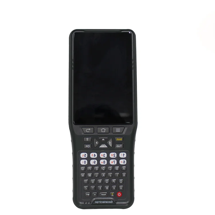
Carlson SurvCE/FieldGenius/Esurvey/SurPAD
Surpad Software Professional,intuitive and efficient
This RTK data controller Field Software is designed & developped by the most professional software R&D engineers team, which brings you a professional, intuitive and efficient measurement of the new experience. The ESurvey software integrates construction survey, power survey, GIS data collecting in one unit. This software is compatible both with Windows Mobile and Android platform, it also supports the smart phone to be used as data controller.
1. Power Survey
Line selection, cross measurement, 4-D Data Format output.
2. Road survey
Road design, Middle Side Stake Layout, Cross section survey.
3. Base Map Loading
Support vector data loading such as DXF, SHP and GCP.
4. GIS collection
Support Attribute Data Collecting by Self-Defined data dictionary and export GIS exchange format.
5. Post Processing Software GGO
Support to convert the data format into RINEX, which is compatible with AutoCAD and other Drawing & Mapping Software. 
| Model | A90 | |
| GNSS | Channels | 800 |
| Signals | BDS: B1, B2, B3 | |
| GPS: L1CA, L1P. L1C, L2P, L2C, L5 | ||
| GLOASS: G1,G2, P1, P2 | ||
| GALILEO: E1BC, E5a. E5b | ||
| QZSS: L1CA. L2C. L5, L1C | ||
| SBAS: L1CA, L5; | ||
| L-Band | ||
| Accuracy | Static | H: 2.5 mm±1ppm , V: 5 mm±1ppm |
| RTK | H: 8 mm±1ppm, V:15 mm±1ppm | |
| DGNSS | <0.5m | |
| ATLAS | 8cm | |
| System | Initialization Time | 8s |
| Initialization Reliable | 99.90% | |
| Operating System | Linux | |
| Merrory | 8GB, support expanable MisroSD | |
| Wifi | 802.11 b/g/n | |
| Blue Tooth | V2.1+EDR/V4.1Dual,Class2 | |
| E-Bubble | support | |
| Tilt Survey | IMU Tilt Survey 60°,Fusion Positioning/400Hz refresh rate | |
| Datalink | Audio | support TTS audio broadcast |
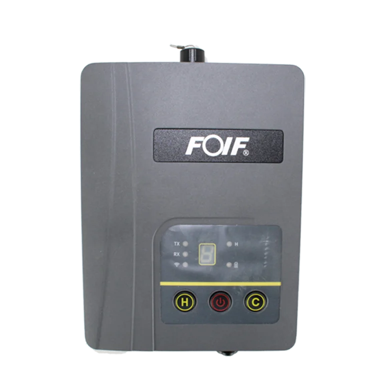
| UHF | Tx/Rx Internal Radio, 1W/2W adjustable, radio support 410-470Mhz | |
| Protocol | support GeoTalk,SATEL,PCC-GMSK,TrimTalk,TrimMark,SOUTH,hi target | |
| Network | 4G-LTE, TE-SCDMA, CDMA(EVDO 2000), WCDMA, GSM(GPRS) | |
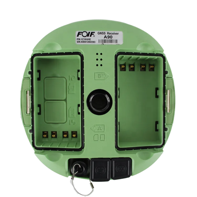
| Physical | Interface | 1*TNC Radio Antenna, 1*5Pin(Power & RS232),1*7Pin (USB 81 RS232) |
| Button | 1 Power Button | |
| Indication Light | 4 Indication Lights | |
| Size | Φ156mm * H 76mm | |
| Weight | 1.2kg | |
| Power supply | Battery capacity | 7.2V, 24.5Wh(standard two batteries) |
| battery Life Timer | Static Survey: 15 hours, Rover RTK survey: 12h | |
| External power source | DC 9-18V, with overvoltage protection | |
| Environment | Work Temporature | -35℃ ~ +65℃ |
| Storage Temporature | -55℃ ~ +80℃ | |
| waterproof&dustproof | IP68 | |
| Humidity | 100% anti-condensation | |