
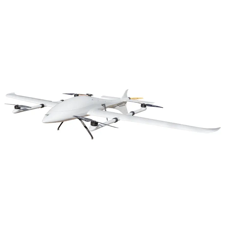

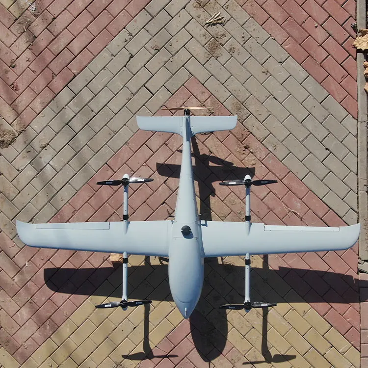
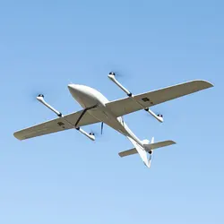
Композитный летательный аппарат дальнего действия Cetus-240 с фиксированным крылом сверхлегкая фотосъемка Аэрофотосъемка составление карты Дрон VTOL UAV самолет для
- Категория: Aircraft >>>
- Поставщик: Huixinghai,Technology,(Tianjin),Co.,Ltd.
Поделиться:
Описание и отзывы
Трекер стоимости
| Месяц | Минимальная цена | Макс. стоимость |
|---|---|---|
| Sep-16-2025 | 0.40 $* | 0.63 $* |
| Aug-16-2025 | 0.97 $* | 0.43 $* |
| Jul-16-2025 | 0.5 $* | 0.32 $* |
| Jun-16-2025 | 0.3 $* | 0.44 $* |
| May-16-2025 | 0.50 $* | 0.72 $* |
| Apr-16-2025 | 0.70 $* | 0.56 $* |
| Mar-16-2025 | 0.26 $* | 0.27 $* |
| Feb-16-2025 | 0.5 $* | 0.58 $* |
| Jan-16-2025 | 0.32 $* | 0.18 $* |
Характеристики


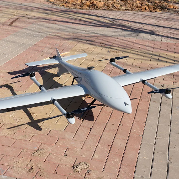
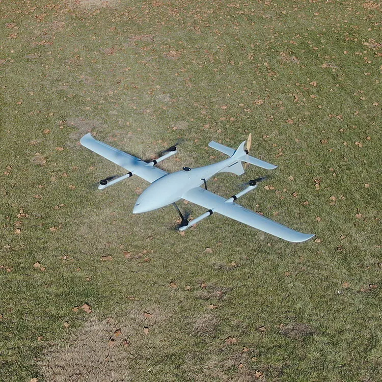
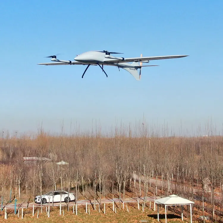
FOXTECH Long Range Fixed Wing Composite Ultralight Survey Mapping Drone VTOL UAV
Cetus-240 VTOL is a perfect platform for mapping and survey. It can do mapping jobs like generating high-precision orthophoto maps and digital elevation models by loading with 3DM V4 oblique mapping camera.
- 3.5h endurance with 1.6kg payload. | 3.5 hours | |
- Highly advanced aerodynamic design. | 10kg | |
- Light weight, high strength and strong anti-interference capability. | 1.6kg (excluding battery) | |
- Unique tail-wing design. The whole tail is designed as an elevator, greatly improves the aircraft lift. | 19m/s | |
- MX16 10km ground control station with video/data/rc all in one can realize drone control, data and video transmission, route planning, real-time flight status feedback and other functions. | 15m/s | |

◆ We test every drone and take videos for client's confirmation before shipping.
◆ We provide 24 hours online technique support.
◆ We can customize the drone according to the application and client's requirements.
Our Main Solutions
1. Mapping, surveying and 3D modeling
◆ We can customize the drone according to the application and client's requirements.
Our Main Solutions
1. Mapping, surveying and 3D modeling
2. Surveillance
3. Inspection
4. Delivery
5. Customization according to application and client's requirements
3. Inspection
4. Delivery
5. Customization according to application and client's requirements


